
Thursday, February 09, 2006
posted 2/09/2006 12:10:00 AM UTC+12, McMurdo Local Time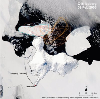
So, here's a modified satellite image showing the general area around Ross Island, which is where McMurdo is, and iceberg C-16's movement over the last several days. It'll be interesting to see what the iceberg does over the next year or two because unless it blows out to sea (north,) it'll most likely have a big impact on the sea ice conditions around here. In this image, the shipping channel is shown as a dotted black line extending from McMurdo (near the south tip of Ross Island) to open water (black.) That shipping channel is the lifeline of McMurdo (and South Pole since it's supported from here,) so if the iceberg stays around and has a negative impact on the shipping channel, it could cause some major problems for getting ships in and out of McMurdo.
And, the big news of the morning, TANKER OFFLOAD HAS BEGUN!!! Sounds like they've been pumping AN8 for an hour or two, and the JP5 offload just got rolling. I just woke up, so am going to get some food then head up to the barn to see what's shakin'.
posted 2/09/2006 12:10:00 AM UTC+12, McMurdo Local Time
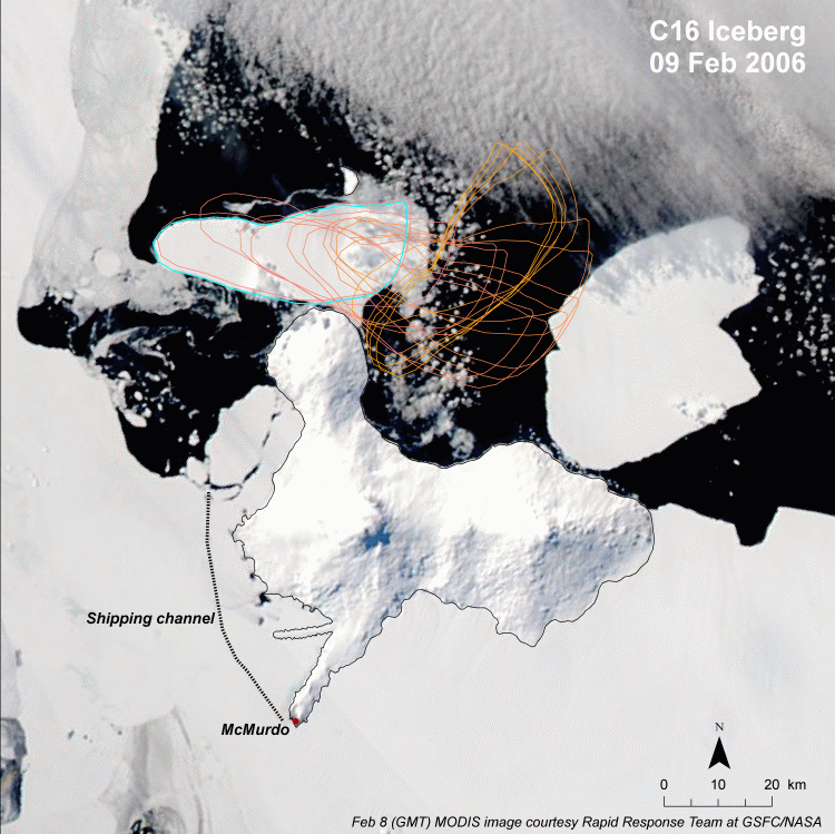
So, here's a modified satellite image showing the general area around Ross Island, which is where McMurdo is, and iceberg C-16's movement over the last several days. It'll be interesting to see what the iceberg does over the next year or two because unless it blows out to sea (north,) it'll most likely have a big impact on the sea ice conditions around here. In this image, the shipping channel is shown as a dotted black line extending from McMurdo (near the south tip of Ross Island) to open water (black.) That shipping channel is the lifeline of McMurdo (and South Pole since it's supported from here,) so if the iceberg stays around and has a negative impact on the shipping channel, it could cause some major problems for getting ships in and out of McMurdo.
And, the big news of the morning, TANKER OFFLOAD HAS BEGUN!!! Sounds like they've been pumping AN8 for an hour or two, and the JP5 offload just got rolling. I just woke up, so am going to get some food then head up to the barn to see what's shakin'.
![]()

